High-resolution LiDAR ups the game in localisation for autonomous racing
Since the invention of cars as a mode of transport people have chosen to dedicate their lives to pushing the boundaries of what is possible, with automobile races tracing their history to the earliest days of the car in 1870s France. Just as people immediately tested the technological limits of early automobiles, today researchers and roboticists across the world test the limits of autonomous driving technology through organised races.
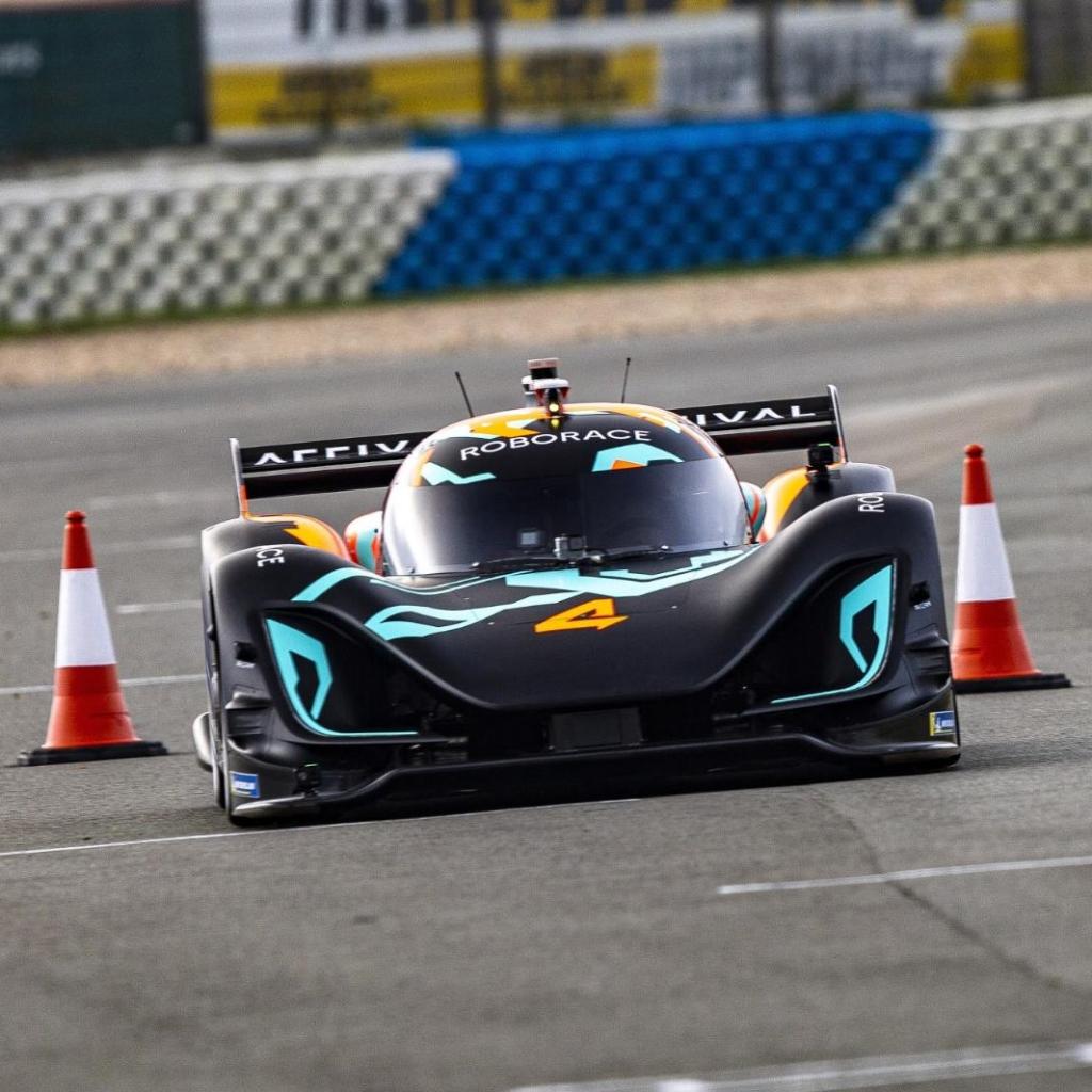
The Roborace series started in 2016 with the development of the DevBot autonomous race car and is pushing the boundaries of autonomous vehicle development through racing. Roborace Season Alpha took place in 2019 and saw the Autonomous Racing Graz team utilise Ouster sensors to push the frontier of autonomous vehicle performance through using high-resolution LiDAR for improved localisation.
Taking on Season Alpha
Autonomous Racing Graz (ARG), a team of researchers from the University of Graz and Virtual Vehicle research who joined forces, competed in two races of the Roborace Season Alpha circuit. Season Alpha consisted of a series of events, many of which were time trials meant to test a team’s ability to overcome certain technical hurdles.
Led by Daniel Watzenig, the ARG team competed in two of these events: the first at Zala Zone in Hungary and the second event at Croix en Ternois in France. The challenges required the race cars to autonomously navigate a race track, driving through narrow gates marked by cones throughout the course. The races are time trials on the course and for each cone hit they receive a time penalty.
A new approach to localisation
To complete the races in the fastest possible time it is critical for the autonomous driving algorithm to know precisely where it is on the race track and choose the correct angles to properly clear the gates without hitting a cone. Traditionally localisation is done using GPS to determine the location of the car. To get an edge in the competition the ARG team opted to pursue a newer approach to localisation: high-resolution LiDAR combined with 3D mapping.
Generally, roboticists use GPS sensors to determine the location of the vehicle on a course. While a tried and true method, GPS depends on maintaining a connection to the global satellite infrastructure, have limitations in accuracy, and are only able to localise the vehicle in two dimensions.
To achieve centimetre level accuracy with GPS the standard approach is to use RTK or real-time kinematic GPS positioning which uses both the satellite network and a reference base station on the ground. For the GPS to operate it also needs a constant mobile data connection to receive position correction information, and equipment that does this at the high speeds demanded by racing is extremely expensive.
Using LiDAR not only improves the accuracy of the vehicle’s localisation it also provides a robust solution that does not depend upon an external data feed for position information. In real-world conditions, GPS can struggle in environments with large obstacles like high-rise buildings, where LiDAR tends to become more robust in cluttered environments as there are more unique features for the algorithm to use to determine location.
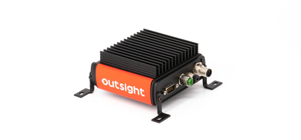
To improve the robustness, accuracy, and enable 3D localisation, the ARG team took an innovative approach using Ouster digital LiDAR. Localising using a LiDAR sensor requires two steps: firstly, using a LiDAR sensor to create a 3D map of the track in advance of the race, and then using a LiDAR sensor during the race to determine the vehicle’s position within the 3D map. The ARG team did not start from scratch for the localisation, they used components from Autoware.AI as a well-developed base and optimised them for racing conditions.
The ARG team first mapped the track using an OS1-64 to create an HD 3D map then using an OS1-16 for localising the car within their high-resolution 3D map.
Unlocking enhanced autonomous performance
High-resolution digital LiDAR unlocks better autonomous performance localisation. Using a LiDAR-based approach with the OS1 the ARG team improved their vehicle’s localisation over what is possible using GPS. LiDAR-based localisation helped them clock the fastest lap and first-place at the race at Croix en Trenois, and second place at Zala Zone.
Racing continues to motivate teams to try cutting edge approaches, and with ARG leaving the competition in the dust, there’s little doubt that more teams will opt for LiDAR-based localisation on the track to try to keep up.
New uses and approaches for LiDAR are being found all of the time, on top of the 100s of applications that are already well established.