An Introduction to Inertial Labs
In the fast paced world of navigation technology, precision, trustworthiness and forward thinking are crucial. Level Five Supplies takes pride in collaborating with top industry partners who share our dedication to quality. Among these partners is Inertial Labs, a well known company specializing in cutting edge Inertial Measurement Units (IMUs), GPS Aided Inertial Navigation Systems (INSs) and Attitude & Heading Reference Systems (AHRSs.
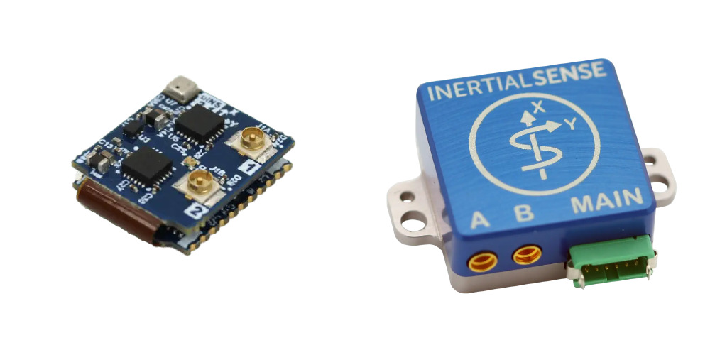
Inertial Labs boasts over two decades of experience in the industry, establishing itself as a trailblazer in the realm of inertial sensing technology. Utilizing highly precise and temperature calibrated MEMS gyroscopes and accelerometers, their team delivers top notch solutions for various applications.
Specialization in Sensor Fusion
The key to Inertial Labs achievements lies in their mastery of sensor fusion. By effectively merging data from multiple sources such as air data computers (ADCs), ToF Mesh Based Software Defined Radios (SDRs), visual odometry, airspeed sensors, odometers, encoders and standalone magnetic compasses (SAMCs), Inertial Labs creates solutions known for their precision and dependability.
A History of Innovation
At the forefront of technological advancement, Inertial Labs is a leader in developing cutting edge technologies such as Inertial Sensing, Assured Position Navigation and Timing (APNT), GNSS Tracking, LiDAR Scanning, Alternative Navigation (ALTNAV), Visual Navigation and Programmable Navigation Solutions. Their dedication to pushing boundaries ensures that their solutions continue to set the industry standard.
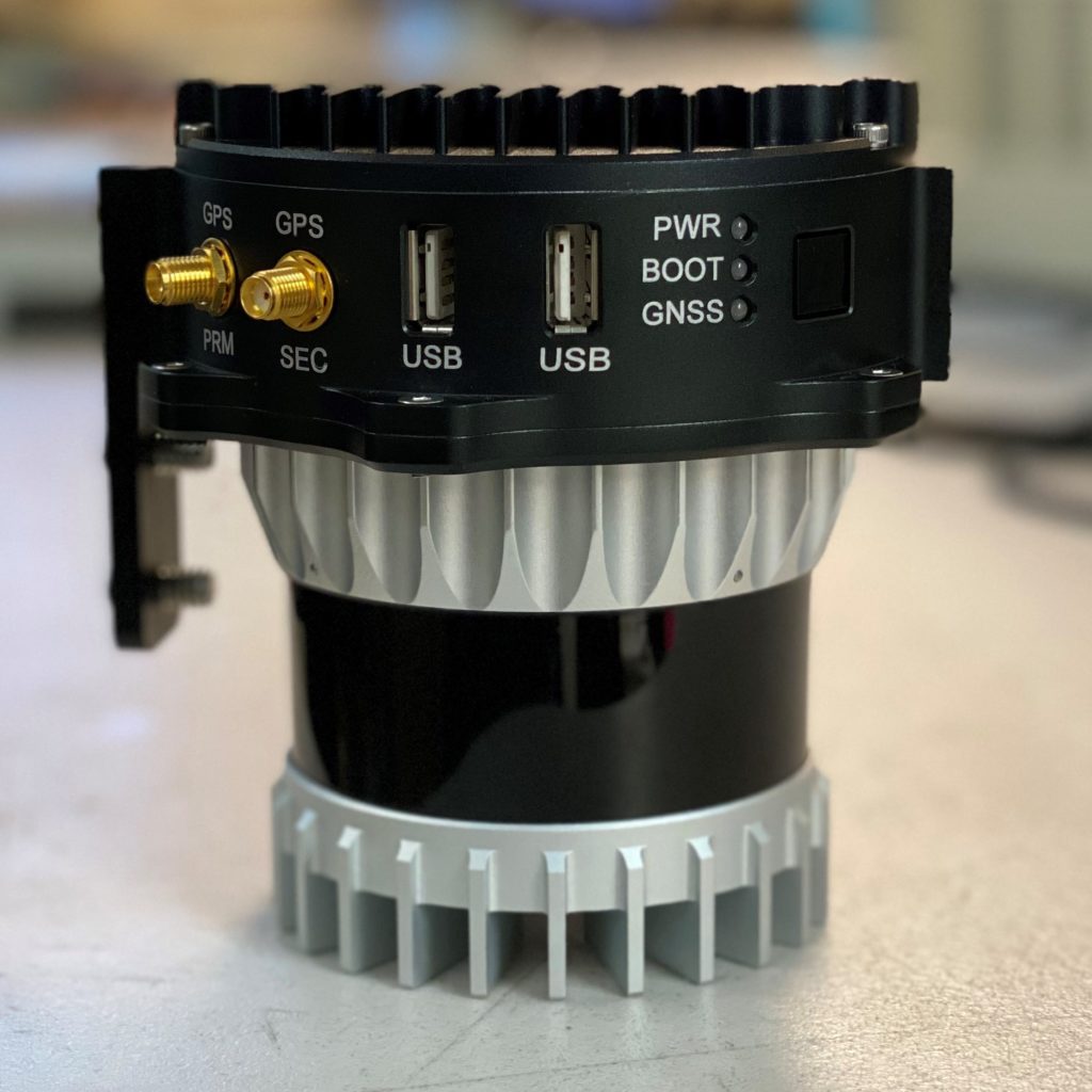
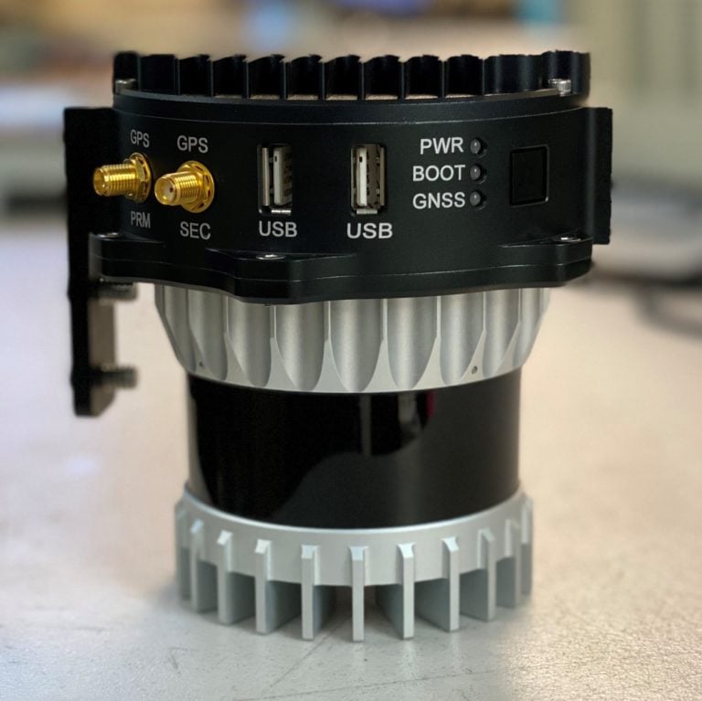
LiDAR Remote Sensing Payload Instrument (RESEPI)
Take your remote sensing capabilities to the next level with the LiDAR Remote Sensing Payload Instrument (RESEPI) from Inertial Labs.
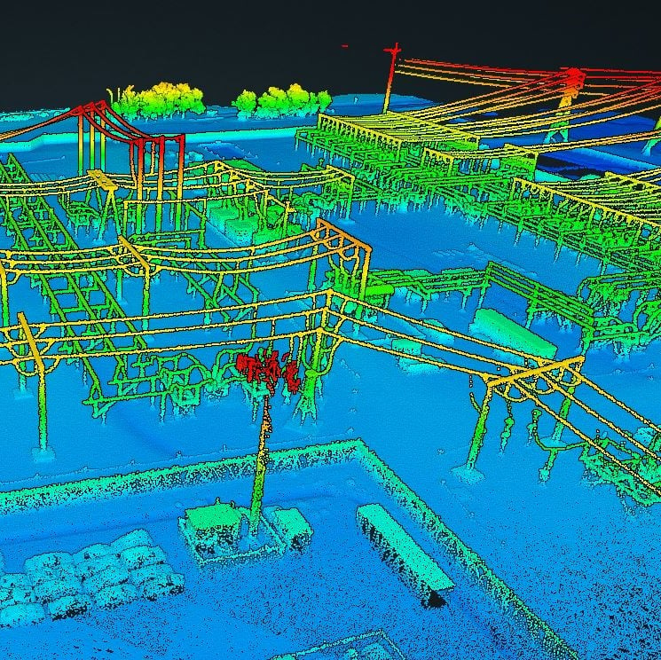
An affordable solution for extremely accurate remote sensing applications, RESEPI is a compact, low power, lightweight system, designed to fit the size and power requirements of any project allowing your drone to fly longer and collect more data. RESEPI’s highly automated software suite with automatic RTK LAS file generation, along with a one-click command-line interface, makes point cloud generation swift and simple.
Compatible with numerous LiDAR sensors, and easily integrated with your UAV platform, RESEPI is suitable for a range of applications, from utility inspection and site monitoring to scanning, mapping and precision agriculture.
LiDAR sensor not included – browse our range here
Price on enquiry
A RESEPI for Success
The Remote Sensing Payload Instrument (RESEPI) marks a significant change in remote sensing technology. This innovative solution merges various advanced components like a Dual Antenna GNSS Aided Inertial Navigation System, datalogger, LiDAR, camera and communication system within a compact and lightweight enclosure. It offers unmatched versatility and functionality by enabling real time and post processed generation of point cloud solutions for precise data capture and analysis. Moreover, its adaptable design facilitates easy customization and integration to support existing partnerships and local production needs effortlessly.
Applications

Mapping and Surveying
Mapping and surveying remain at the forefront of remote sensing applications, and RESEPI™ is a game-changer in this domain. By leveraging advanced LiDAR technology, RESEPI™ enables the creation of highly detailed maps and 3D models, providing businesses with crucial insights into the physical world. These accurate representations allow for faster, more informed decision-making, boosting efficiency, profitability, and safety. RESEPI™ can be seamlessly integrated into land vehicles or Unmanned Aerial Vehicles (UAVs), making it an incredibly versatile tool for a wide range of mapping and surveying tasks.

Agriculture
In the field of precision agriculture, RESEPI™ proves to be invaluable. Utilizing LiDAR technology, it facilitates the development of 3D models of farmland, which are essential for efficient crop planning and natural resource management. Farmers can use RESEPI™ to create precise maps for crop yield forecasting, field management, land segmentation, and soil type determination. This data-driven approach helps optimize agricultural practices, leading to enhanced productivity and sustainable farming operations.