100 Uses of Drones part one
Our fascination with drones and the incredible opportunities they present to better understand and engage with the world around us seems to increase year on year. There are thousands of ways in which this technology is making our world a more efficient and accessible place, and today we share 100 of the top uses of drones, and some of the ways this innovative technology is shaping our world.
Remember: drones aren’t a new technology
Uncrewed aerial vehicles (UAVs), commonly known as drones, have been around in some form or other since the mid-1800s, where they were used as balloon carriers in naval aviation. While they may have a long military history, their uses in other areas (spoiler alert) such as transport, agriculture, and law enforcement are relatively new.
There are many and varied uses of UAVs both in the modern age and looking forward, showing just how versatile and game-changing these systems are.
Our top 100 uses of drones
Aerial mapping and surveying
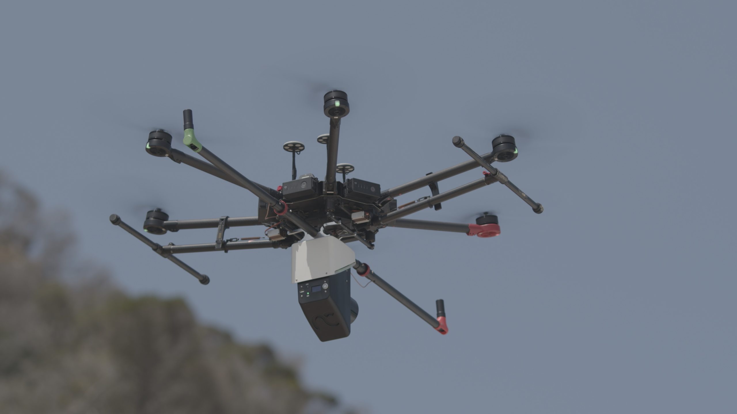
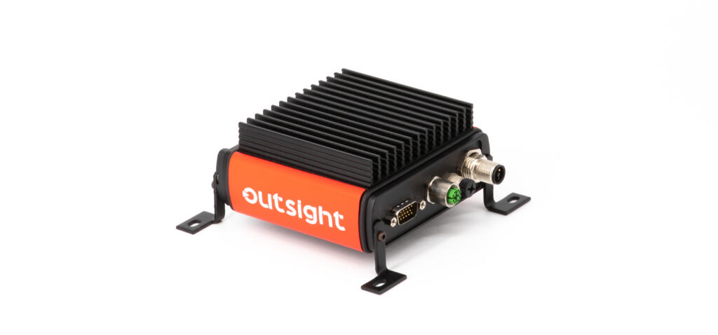
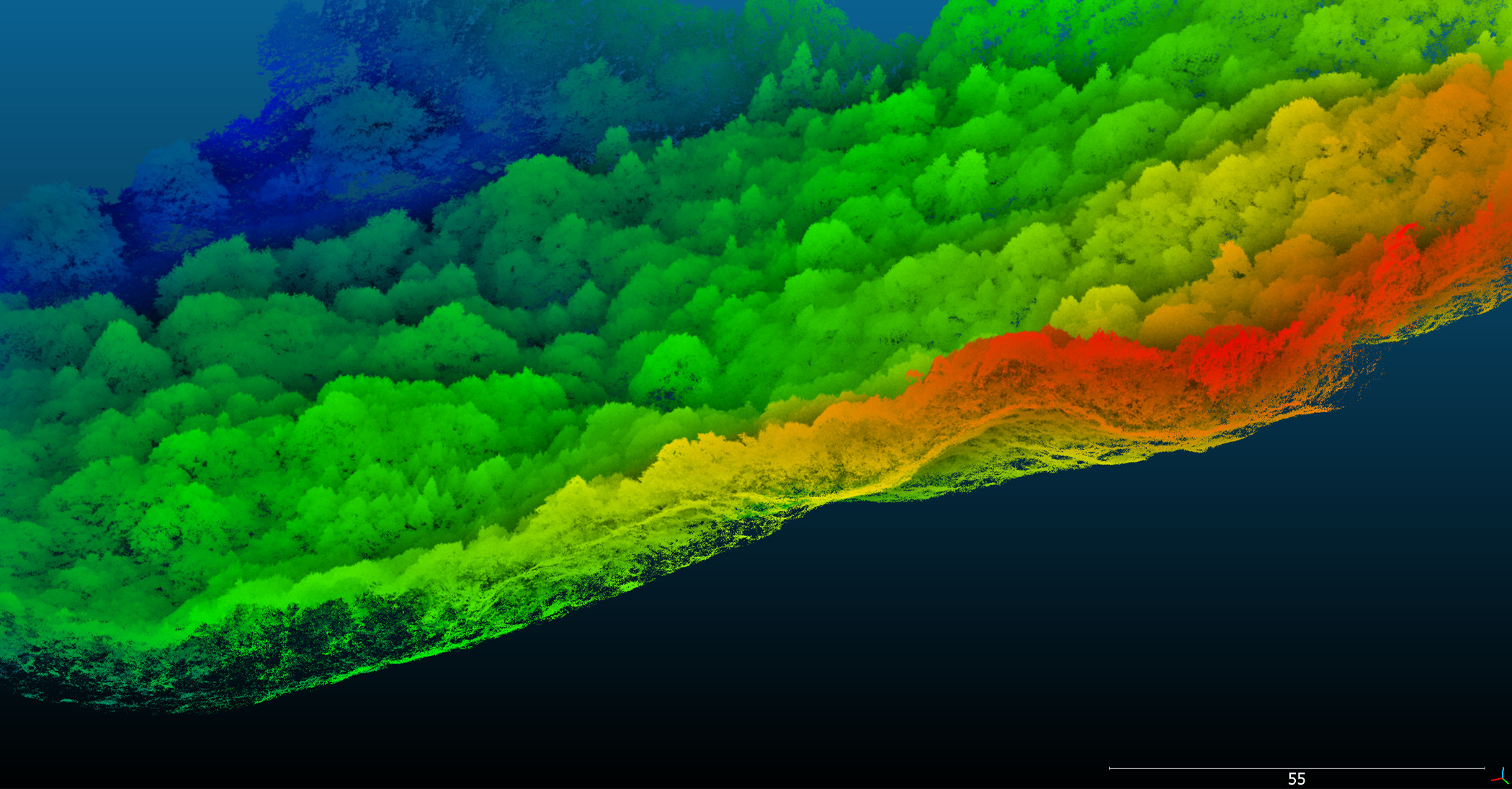
Cheaper and more efficient than helicopters, UAVs are the ideal option for all kinds of aerial surveying tasks. With a drone, it is possible to (1) survey and map land in a fraction of the time and with far less labour than traditional methods, capturing high-quality aerial data with RGB cameras or LiDAR sensors. In fact, LiDAR is used as a sensing solution in an increasing number of applications as this reliable, accurate technology can be easily integrated with a range of platforms.
Infrastructure monitoring for buildings, bridges, pipelines, and railways
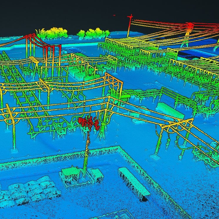
This process can be vastly improved with the use of drones, saving time, reducing the number of people needed to carry out inspections, and providing a safe and easy way to obtain a detailed view of hard-to-reach places (2). Likewise, drones can also be used to (3) inspect power lines and pylons for bird’s nests, lightning strikes, corrosion, and damaged bolts, flying close enough to safely obtain high-resolution images and data.
Geological mapping
UAVs have a key role to play in (4) geological mapping, particularly in mountainous areas. Traditional mapping is a complex and time-consuming activity—especially when carried out in steep and potentially hazardous environments—and does not always yield a comprehensive overview of the area or the properties of the terrain. Check out our five top tips for drone surveys.
Agriculture
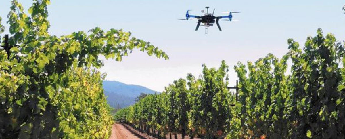
You heard it here first: agricultural drones are the next big revolution in farming. Using sensors and digital imaging, agricultural drones can give farmers a full picture of their operations, including (5) monitoring and cultivation of crops and (6) overseeing livestock. In real terms, this means less time spent scouting fields and roaming around the farm.
However hard one tries, it’s virtually impossible to inspect hundreds of acres of crops on foot. Not so with a drone. As time goes on, we expect them to become an important addition to any farmer’s toolkit. Commercial drones can even help with the (7) vinification of your favourite vintage—a very noble cause indeed.
Commercial UAVs like the nimble Inspired Flight IF750 quadcopter are ideal platforms for use in agriculture, land management, and farming. The IF750 can (8) cover far more ground at a far quicker pace than a tractor, saving time and money.
There are so many ways in which drones can transform the way farmers can manage their complex work. Drones can use the data gathered from monitoring crops and use it to (9) predict a potential harvest, so farmers can plan ahead. They can also (10) plant seeds and pollinate flowers, working side by side with the declining number of bees to improve crop yields. By using drones to gather data, farmers can start to plan more effectively and ensure that their operations are efficient and avoid costly issues way in advance.
Commercial and Retail
There are lots of cool business uses for commercial drones, particularly in areas like manufacturing and fulfilment. For starters, low-flying UAVs can be used to (11) discover sources of raw material, equipped with cameras and sensors that detect metals like copper, cobalt and lithium, as well as rare minerals.
Drones’ ability to carry out (12) assembly line inspections have a massive potential for manufacturing, using infrared and thermal technology to detect problems with equipment and perform quality assurance. In addition, drones have a role to play in (13) inventory management, with their ability to hover, locate and identify items offering numerous cost and safety advantages.
Last but not least, UAVs are set to transform logistics by enabling (14) drone delivery, autonomously navigating their way to a user-specified delivery location—the concept behind Amazon Prime Air. The service promises 30-minute delivery of packages weighing less than 5lbs / 2.27kg within a 10-mile radius of a fulfilment centre. The energy and resource-saving this will offer will likely transform the logistics of commercial delivery forever.
Conservation
But it’s not all about turning a profit. Drones have an important role to play in the protection and preservation of our planet and its ecosystems. The WWF outlines best practices for using drones effectively while minimising the impact on wildlife, such as modifying drones to reduce noise or disturbance and choosing sensors that can capture data from a safe distance.
Drones with cameras and/or GPS technology can be used to (15) keep track of endangered animals, counting and monitoring species over vast areas. Not only are they less invasive than human trackers, but they are also shown to be more accurate. Wildlife drones enable conservationists to (16) conduct research without disturbing natural habitats, not to mention providing a safer and easier way to explore harsh and inhospitable regions.
Custom drones with built-in containers also allow scientists to (17) collect biological samples cheaply and non-invasively. SnotBot, a modified consumer drone created by Ocean Alliance, is used to fly through the blow of a whale and collect exhaled mucus on Petri dishes, providing valuable data such as DNA, stress and pregnancy hormones, and microbiomes. This is certainly an example of a job no human would be capable of achieving without significant risk to physical wellbeing; wading through snot is not a module offered in any Marine Biology course we’ve come across!
Elsewhere, drones have found yet another use in the (18) fight against illegal poaching. In South Africa, drones and sirens have been used to combat the poaching of southern white rhinos, deterring them from entering areas where the poaching risk is high. Because most poaching happens under cover of darkness, the team behind Air Shepherd—a pioneering group of conservationists, entrepreneurs and researchers—uses UAVs equipped with cameras and heat-sensitive infrared optics to catch poachers in the act, sending intelligence back to rangers on the ground. Again, the safety implications are profound, preventing the risk of retaliation from poachers against conservationists observing on the ground,
Disaster relief and emergency response
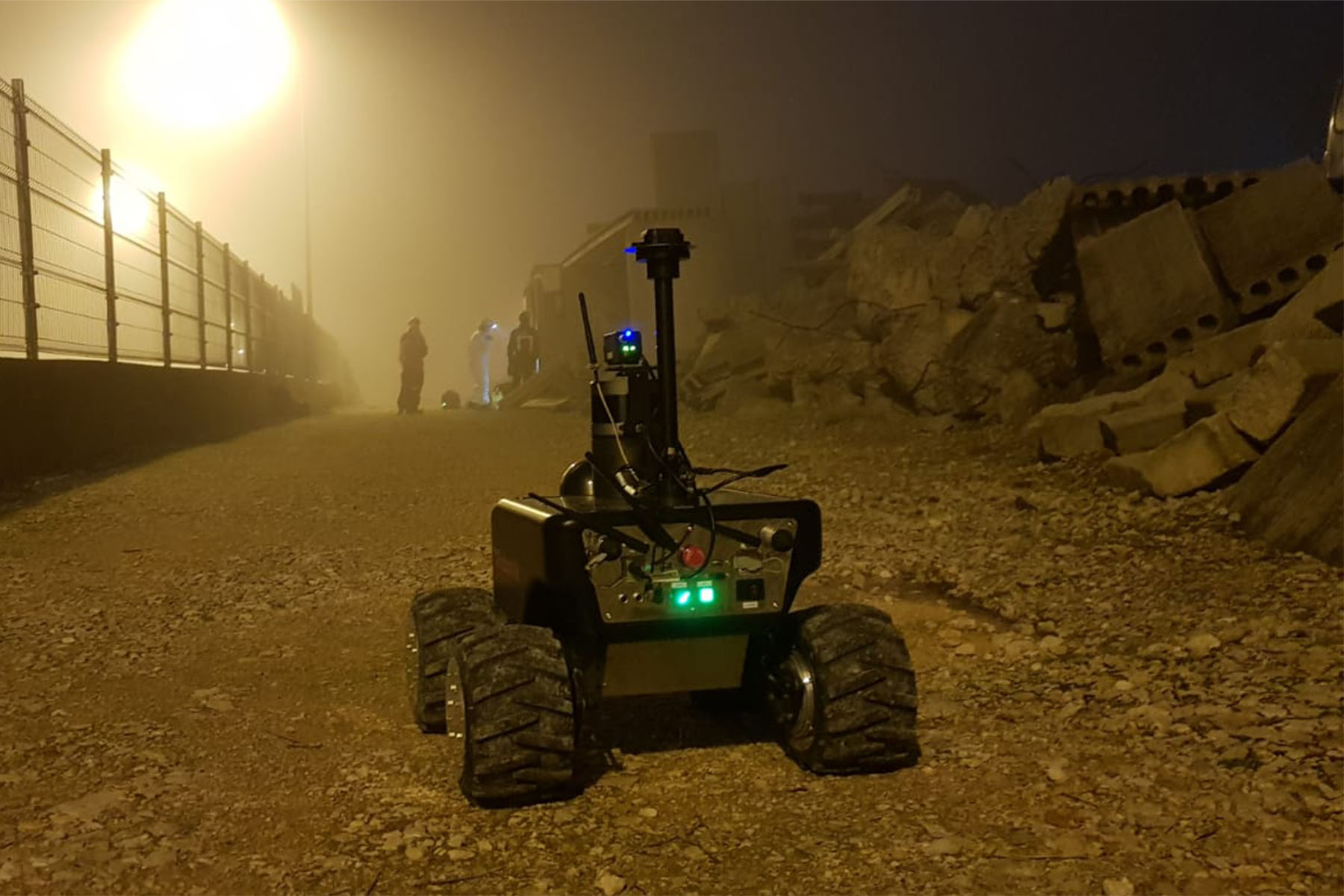
Drones are increasingly being used to assist with both disaster relief and emergency response (19), thanks to their ability to fly in low visibility, provide rapid situational awareness, and drop supplies where they are needed.
Equipped with thermal imaging cameras, drones can be deployed to (20) search for missing people and survivors, providing a cheaper and safer option than sending in rescue helicopters right away. They also offer a quicker way to (21) deliver essential items such as food, water and medical supplies. An NHS drone delivery trial in the Scottish Highlands reduced the delivery time of critical cargo between hospitals from 6 hours by road to just 15 minutes by drone.
Responders can also use drones to (22) assess damaged infrastructure in the wake of a natural disaster, providing crucial imagery of roads, homes, buildings, bridges and waterways to supplement the use of manned helicopters. Not only do they provide invaluable information in the event of a natural disaster, but they can also help to prevent them entirely—or at least give people time to prepare. The ongoing observational benefits of drone use help us build a picture of our environment over time, helping to develop data and algorithms that can anticipate areas of high risk (23).
UAVs are very helpful in (24) identifying the premature signs of a forest fire, as well as monitoring them during extinguishing. They also help us to (25) forecast extreme weather more accurately; some scientists use drones to actively hunt hurricanes, sending them into the eye of the storm to record data and predict their paths and intensity.
Disease control
Drones have a pioneering role to play in the fight against disease outbreaks. Mosquito control is a key area, with malaria responsible for the deaths of upwards of 400,000 people per year, not to mention other mosquito-borne diseases like Zika virus and dengue fever. Drones may be used to scout and spray mosquito breeding sites (26), as well as to catch and test the mosquitos in order to mitigate future outbreaks (27).
During the coronavirus crisis, drones had several applications in containing the spread of the virus, not only in the form of medical deliveries (28) but also lockdown/curfew enforcement (29), spraying streets with water and disinfectant (30), and body temperature scanning (31).
Precision mapping using drones is (32) helping communities at risk of schistosomiasis: a disease caused by parasitic flatworms, also known as ‘snail fever’. Precision mapping of snail habitats using drones, as well as identifying and targeting snail clusters, could help to reduce the risk of the infection spreading to people.
Energy services
Energy infrastructure can be a high-risk business and presents a range of challenges for engineers to navigate. Drones can access areas that are simply too dangerous for people—working at height or in high temperatures. The inspection of oil and gas infrastructure using thermal sensors is one way that drones are transforming the efficiency of the complex processes involved (33). Drones are being used to locate dangerous leaks (34), identify issues with equipment (35), identify new drill sites for fracking (36) and gather geological information using electromagnetic sensors (37).
Drones also offer access to problematic nuclear sites (38), collecting important data in radiologically contaminated areas. These UAVs synchronise radiation readings and other relevant information with exact GPS positions enabling photographic and geographic information to be linked together with the corrected data of the radiation measurements.
Drones are also playing an important part in the design configurations for new solar panel arrays (39), providing geographical and sunlight data to ensure that not only are the panels in the right place but also track optimum exposure to the sun.
A slightly tangential use for drones in energy is the role they are playing in nuclear site security (40). A major concern for nuclear site owners is keeping the power station secure 24/7. UAVs offer a solution, allowing observation of entry routes otherwise more difficult for security officers to access on foot, like waterways and dense vegetation.
Art and entertainment
Drone light shows could be the next big way for marketers to showcase their new products in synchronised light shows (41). Recently, Cygames staged a celebration of their new video game with 1,500 LED-equipped drones forming a massive, scannable QR code in the sky. The drones then flew into the shapes of their three in-game characters, who then battled a dragon in the sky. It doesn’t get much cooler than that, right?
Disney has also developed some impressive drone technology for its theme parks. These innovations include creating flying displays using drone pixels (42), which could eventually replace fireworks, drone ‘puppeteers’ for flying puppet shows (43) and even giant drone projection screens (44). Ever safety-conscious, all their drones have an airbag to keep the audience safe in the case of malfunction.
Outside of Disney, the team at The Wizarding World of Harry Potter have spent two years developing a jaw-dropping light show (45) at their parks, which ends with Harry’s Patronus, created by an army of drones, appearing as if by magic in the night sky.
Back in 2015, Katsu, an artist based in New York City, used a drone to tag a billboard as a ‘way of disrupting the order of our everyday landscape’. His small, customized drone, outfitted with a paint sprayer, was used to disrupt an image of the model Kendall Jenner with red stripes of paint (46).
Filming
This is by no means a new use for the drone, but capturing dramatic aerial perspectives without helicopters (47) has offered filmmakers some amazing choices when it comes to their shots, without all the associated costs. UAVs also offer a way of gathering action footage that puts the camera in the centre of the action (48), moving with actors, and again, getting places humans simply wouldn’t be able to. A good example is the 2012 Bond film, Skyfall, which opens with a breathtaking motorcycling chase filmed by drones.
CBS Sports has announced that its coverage of the next PGA Championship will include live drone footage, wind analysis, robotic camera bunkers and Fly Cams—all of which will add new perspectives for spectators (49). Red Bull TV is also using drones to capture footage of their extreme sports, including some stunning examples of MX Freeriding.
100 uses of drones part two
The second part of our run-down of the 100 uses of drones will explore UAV applications in everything from healthcare and education, to construction and security. Sign up for our regular newsletter for all of the latest updates.