100 Real-World Applications of LiDAR Technology
LiDAR stands for ‘light detection and ranging’. An active form of remote sensing, LiDAR technology measures the distance between objects by hitting the target with a laser and analysing the reflected light. Using these systems, scientists and professionals can investigate natural and man-made environments with both precision and flexibility.
Related reading: LiDAR: How Does It Work?
LiDAR sensors are used by autonomous vehicles to navigate their environments, but they have many additional applications, across various industries and fields. We’ve collected 100 uses for this incredibly versatile technology.
Digital elevation models
Digital elevation models (DEMs) are used to create a 3D representation of a terrain’s surface. Before LiDAR, we relied on ground surveys or photogrammetry, both of which were relatively slow. LiDAR has since made this process quicker and easier.
Imaging
3D LiDAR imaging is a fast-growing industry, with notable commercial interest for autonomous cars and robotics. But the possibilities for future use are endless, with a growing interest in LiDAR imaging for healthcare, smart devices, aerial surveys, geosciences, and more.
Agriculture
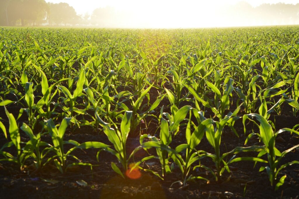
Crop viability
Population growth has put pressure on agricultural production and the gathering of reliable harvest statistics worldwide. Accurate data on the state of fields and crop conditions at each stage of growth is critical to farmers achieving their goals. LiDAR can be used for topographic analysis and prediction of soil properties in agricultural landscapes. Using these insights, farmers can analyse, model and predict crop yields in any given place, maximising profits.
Crop categorisation
Additionally, with LiDAR technology, it is now much easier to categorise crops based on their characteristics and find the best places to plant them. A crop may thrive in one area of the farm, but may not do well in another area. The Department of Engineering at Aarhus University used UAV LiDAR to map crop fields growing wheat.
Crop mapping
LiDAR is also used to control crop yield through precision agriculture. The technology can be used to create an elevation map, which farmers can use to predict crop yield, determine which crops to plant in a given area, and save on expensive fertiliser.
Astronomy
Astronomy
Did you know that LiDAR technology is used by NASA? During the Apollo program, retroreflectors were placed on the moon, which were used to reflect lasers beamed from observatories on Earth. LiDAR is also capable of mapping the surfaces of celestial bodies – it was used to generate a precise global topographic survey of Mars in 2001.
Topography of Mars
LiDAR technology was used to create a topographic map of Mars back in 1999. The laser pulses travelled at a very high speed to Mars, creating a 3D model of the planet and returning the data to earth. NASA’s Phoenix Lander also used LiDAR technology to detect snow falling. The Mars Meteorological LiDAR now provides cloud, fog, and dust plume data, leading to a better understanding of the planet’s climate.
Lunar laser-ranging
LiDAR has been used as an ongoing part of the Lunar Laser Ranging experiment, measuring the distance between the surfaces of Earth and the moon. Laser light pulses are transmitted and reflected back to Earth and the round-trip duration is measured. The findings of this experiment have shown us that the moon is spiraling away from Earth at a rate of 3.8 cm/year.
Atmosphere

Molecular density
LiDAR can be used to study atmospheric gases, aerosols, and clouds. Molecular scattering decreases with increasing wavelength, allowing the system to build a ‘density map’. The data collected by LiDAR is highly accurate, giving an exact estimation of the molecules comprising any form of matter.
Pollution modelling
LiDAR can detect particles in both air and water, which makes it particularly adept at identifying pollutants like carbon dioxide, sulphur dioxide and methane. Together with a building or terrain model, researchers can use this data to observe and reduce pollutant build-up in a given area.
Meteorology
Early LiDAR technology, known as ‘elastic backscatter LiDAR’, was developed for the study of aerosols and clouds, ideal for looking at atmospheric composition. DIAL (Differential Absorption LiDAR) is used to identify particular forms of gas in the atmosphere, while Raman LiDAR measures concentration and Doppler LiDAR measures wind speed.
Atmospheric physics
DIAL can be used to measure atmospheric gases, aerosols, clouds, and temperature, as well as concentrations and fluxes of pollutants. Most often, it’s used to detect and measure potentially hazardous gases such as volcanic sulphur dioxide, atomic mercury and hydrocarbons.
Cloud profiling
LiDAR pulses are capable of penetrating the clouds. As such, they are used to measure cloud statistics, such as heights and phases. Researchers in the Australian Antarctic Science project collected aerosol data above the Southern Ocean to improve their understanding of the connection between clouds and climate change.
Aerosol distribution data
Atmospheric LiDAR uses laser light to study atmospheric properties, measuring the concentration and distribution of atmospheric gases and aerosols. It can be used to monitor air quality over urban or industrial areas, as well as forecasting of the dispersion of trace gases and aerosols in the first layers of the atmosphere.
Gas composition data
DIAL is used to measure particular gases in the atmosphere, such as ozone, carbon dioxide or water vapour. We can use LiDAR to study the gas composition of the atmosphere, necessary for weather forecasting, climate modelling and environmental monitoring.
Autonomous vehicles
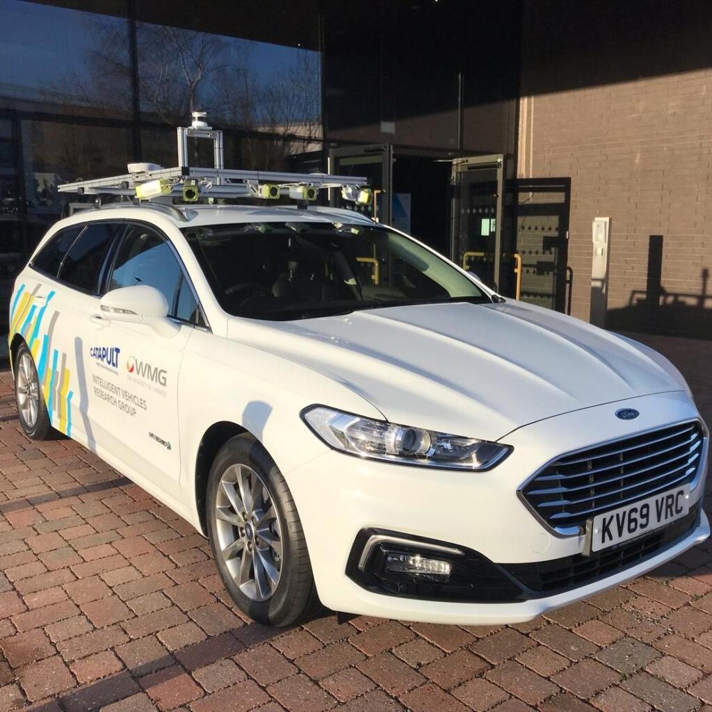
Navigation
This one comes as no surprise. LiDAR is becoming ever more popular as a guidance system for autonomous vehicles, thanks to its speed and accuracy, which allows the vehicle processor to ‘see’ obstacles and update its trajectory within seconds.
Collision avoidance
Collision avoidance systems are designed to – as the name suggests – prevent or reduce the severity of a collision. They operate using different sensors. LiDAR sensors determine the exact position of obstacles in the surrounding environment, generating data that will steer vehicles in the right direction to avoid making an impact. This technology is particularly useful for the development of autonomous and self-driving cars.
Autonomous cruise control
LiDAR has been used in adaptive cruise control (ACC) systems for automobiles. Adaptive cruise control (ACC) is a cruise control system for road vehicles that automatically adjusts the vehicle speed to maintain a safe distance from vehicles ahead. In vehicles with ACC, a LiDAR device mounted on the front of the vehicle is used to monitor the distance between that vehicle and any car in front of it.
Obstacle detection in autonomous vehicles
LiDAR enables a self-driving car to observe the world with 360 degrees of visibility and accuracy of ±2cm. It continually fires off beams of laser light and then measures how long it takes for the light to return to the sensor. LiDAR allows you to generate huge 3D maps, which you can then navigate the car predictably within.
Biology and conservation
Biology and conservation
LiDAR remote sensing offers various practical uses in conservation and ecological research. It has been widely used to assess habitat quality for various species, as well as to map areas where flooding and drought might occur. In one study, LiDAR was used in the conservation management of red squirrels.
Biodiversity
LiDAR remote sensing can be used to assess biodiversity by monitoring habitat structure; a key indicator of species diversity. Much like wildlife, the technology has evolved over the years to provide detailed information about the forest, looking at factors crucial to survival, such as vegetation structure.
Coastline management
There are two different types of LiDAR: topographical and bathymetric. The former uses an infrared laser to map the land, while the latter uses water-penetrating green light. In tandem, they can be used to form coastal surveys, giving maximum overlap between land and sea and in doing so, minimising data gaps.
Flood modelling
Urban flooding is becoming more and more frequent. Buildings, roads and riverbanks all have a notable effect on flood dynamics. LiDAR data provides the advanced topographical information needed to create effective flood relief simulation software.
Earthquake damage
LiDAR data and imagery is sometimes used to conduct a post-earthquake assessment of building damage, allowing authorities to identify hard-hit buildings quickly. Timeliness in recognising damaged buildings after an earthquake can save lives – hastening rescues from compromised buildings.
Morphology
Morphology is the branch of biology that deals with the form and structure of organisms. LiDAR may be used to investigate the evolution and characteristics of morphology and forecast future patterns of change. This enables widespread biogeomorphic characterisation along coasts, for example, benefiting both researchers and coastal managers alike.
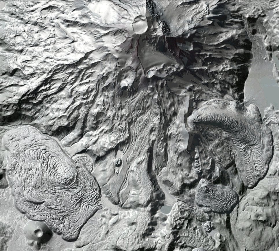
Glacier changes
As the need to address climate change becomes increasingly urgent, LiDAR technology has an important role to play in collecting data around glacier level changes. This data tells experts how much of the glaciers have melted – and what this means for the rest of the planet.
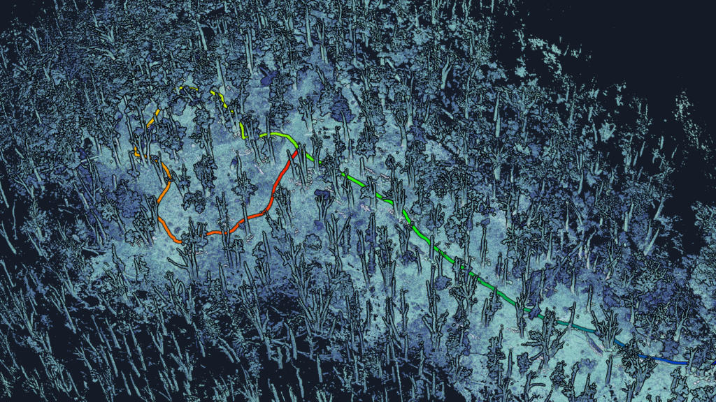
Study of forest ecology
LiDAR has a lot of benefits in ecology – particularly forest ecology. While it can be difficult to obtain forest ecology data manually, LiDAR is able to collect vast amounts of detail on forest flora and fauna. Ecologists can use this data to design and implement effective conservation strategies.
Oceanography
In oceanography, LiDAR data is used to collect a range of details regarding the ocean, including depth, composition, general biomass and phytoplankton fluorescence. Researchers may also use LiDAR systems to find out what species exist in the deep sea – and in what numbers.
Dune monitoring
Beach and dune monitoring is a vital process necessary for understanding morphological changes in coastal environments. LiDAR can be used to monitor dune activities, including changes in size, shape and vegetation. Coastal surveying companies increasingly make use of both 3D laser scanning and high precision GPS, combining the methodologies into a single unified approach.
Tsunami prediction
Tsunamis can claim thousands of lives and cause serious damage to infrastructure. LiDAR technology can be used to model and forecast the severity of an oncoming tsunami, helping scientists to understand which areas will be affected. DEM gives the elevation value of the seashore, while bathymetric data provides underwater elevation.
Watershed and stream delineation
DEMs generated from LiDAR can be used to establish watershed areas and streamline delineation using GIS software. This allows researchers to calculate the watershed for a given body of water and predict the likelihood of flooding.
Stormwater management
Integrated Stormwater Management Plan (ISMP) has become a popular alternative to traditional methods of stormwater management. Its goal is to balance land use planning, stormwater engineering, flood protection and environmental protection. LiDAR data is used to create an accurate and precise elevation map from which to work.
Estimation of carbon absorption
LiDAR technology can be used to gather accurate data regarding the forest, including the level of carbon absorption. Carbon absorption cannot be accurately determined using other forms of measurement. Differential Absorption LiDAR (DIAL) measures the exact amount of carbon absorption, helping to create a profile of the forest. This data is then used to determine the amount of carbon within specific locations, helping researchers make improvements.
Landslide analysis
Landslides occur on every continent, with some regions experiencing more landslides due to specific geologic and hydrologic conditions. Historically, researchers have relied on routine aerial and field patrols to obtain systematic landslide information. The advent of affordable aerial LiDAR and high-resolution DEM has made it possible to obtain accurate regional landslide information at a higher frequency, improving safety and asset integrity.
Measurement of water surface roughness
LiDAR may be used for water surface mapping to detect and evaluate roughness. Conventional LiDAR does not penetrate water bodies – additional bathymetric measurements are necessary to achieve this. Modelling water surface topography into a DEM is an important research area in fields connected with hydrology modelling.
Vulnerability studies
LiDAR is used to assess the vulnerability of various risks facing humankind. It is now much easier to track and plan for disasters such as tornadoes, landslides and tsunamis, limiting damage and loss of life. Scientists may use LiDAR to support activities such as storm surge modelling, hydrodynamic modelling and shoreline mapping.
Forestry
Forestry management
LiDAR has the uncommon ability to measure forest canopy structure, as well as the ground underneath. This allows for cost-effective, large-scale surveys that were not previously feasible. It can also be used to calculate fuel capacity and root expanse.
Precision forestry
Precision forestry involves the use of intelligent forestry systems to make data-driven decisions. LiDAR provides a detailed reading of forest dynamics, enabling organisations to collect meaningful data.
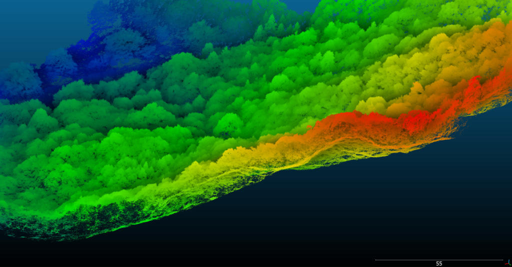
Forest canopy measurement
LiDAR can be used to determine both canopy density (ratio of vegetation to ground) and canopy height (how far above the ground the top of the canopy is). Until now, forest canopy measurement was not easy, with previous techniques yielding largely inaccurate information. LiDAR solves this problem, offering data that determines the exact quality of the trees.
Deforestation
LiDAR technology has an important role to play in deforestation, identifying the areas of the forest affected by humans. It allows researchers to measure the three-dimensional structure of tree canopies, including their height and the diversity of canopy elements like leaves, twigs and branches. The data could prove critical to the United Nations’ REDD initiative; the biggest future source of funding to protect the planet’s tropical forest.
Lumber inspection
There is great potential to be explored when it comes to LiDAR-based timber growth monitoring and forest inventory. Terrestrial laser scanning provides more precise information on individual tree dimensions and the overall timber volume of a forest, compared to photogrammetry, which has limited canopy penetration. LiDAR 3D mapping allows environmental management organisations to gain better intelligence and improve monitoring techniques.
Forest fire management
Around the world, fire departments are discovering how to use LiDAR technology to manage forest fires. LiDAR data can be used to observe fire patterns and determine high-risk areas (known as fuel mapping), so proactive measures can be taken to circumvent a blaze.
Geology and soil science
Geology
LiDAR data has proved to be an essential tool for mapping, monitoring and managing natural hazards and resources, allowing geologists to study earth topology and its origin through a process known as geomorphology.
Micro-topography
LiDAR sensors can capture high-resolution micro-topography of areas otherwise hidden by trees and greenery, penetrating through the forest canopy to detect the surface underneath. In 2012, it was used to find the legendary city of La Ciudad Blanca in Honduras.
Soil profiling
LiDAR technology is able to determine the profile and roughness of different agricultural soil types, informing decisions about crop planting, tillage and which manure type to use for best results.
Green energy
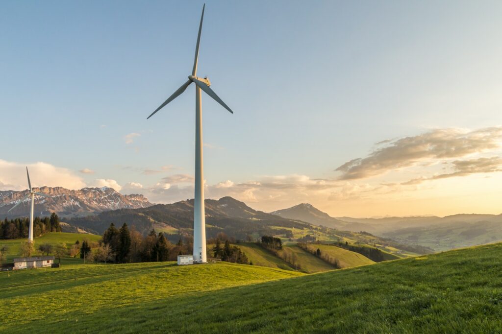
Wind turbines
Scanning wind before it hits the wind turbine can help to maximise efficiency. LiDAR attached to the turbine itself is used to calculate the direction and strength of wind, and if necessary will change the direction of the blade in order to generate more power.
Measurement of wind speed
Accurate measurement of wind speeds is crucial for effective siting of wind farms. LiDAR measures wind speed higher, further and faster than traditional met masts, calculated based on the scattering of beams. Sensors can be installed on top of a wind turbine to measure wind conditions in front and behind.
Solar energy planning
Solar energy is an increasingly popular source of renewable energy; using solar panels to absorb heat from the sun and convert it into electricity. LiDAR data helps to identify some of the basic requirements for solar panel installation, such as whether the roof is south-facing and minimum area requirements.
Law enforcement
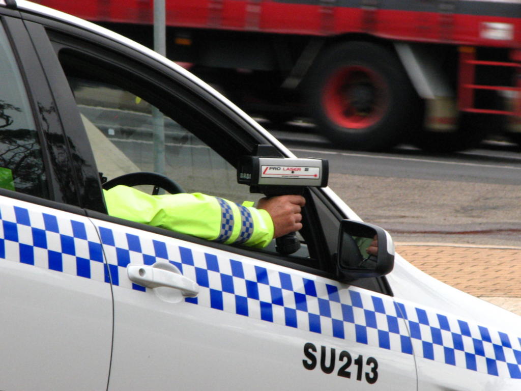
Law enforcement
LiDAR has a wide range of applications in the field of law enforcement, from speed limit enforcement to 3D recording of accidents and crime scenes. It can be mounted on a patrol vehicle or deployed via UAV. LiDAR can also be used in forensics, even so far as blood splatter analysis.
Crime scenes
LiDAR systems offer a simple and exact way of recording of accidents and crime scenes. Ground-based LiDAR can be used to capture the scene of a car crash within a few minutes, preserving the evidence and noting its geographical location.
Forensics
3D laser scanning is becoming increasingly popular in forensic examination, embraced by police departments, law enforcement agencies and government crime agencies. Forensic investigations always begin with the collection, review and analysis of evidence. LiDAR is an extremely useful tool for collecting detailed evidence quickly, obtaining tens of thousands of point measurements per second.
Fingerprints
There are hundreds of reported techniques for fingerprint detection. Traditionally, fingerprint detection has been achieved through the use of chemical reagents, such as ninhydrin or diazafluorenone. As technology moves on, fingerprints can actually be visualised in 3D and without chemicals through the use of infrared lasers. These scanners may eventually do away with dusting altogether, as they are able to scan fingerprints in seconds.
Speed guns
One of the most common uses of LiDAR technology in law enforcement is speed guns, which use laser pulses to calculate the exact speed of a passing vehicle and determine whether the driver is exceeding the limit.
License plate recognition
Vehicle registration plates are an important part of traffic enforcement, and systems for automatic number plate recognition (ANPR) play a crucial role in many security applications. LiDAR technology is used for vehicle recognition and can reliably recognise license plates – even at high speeds and in heavy traffic.
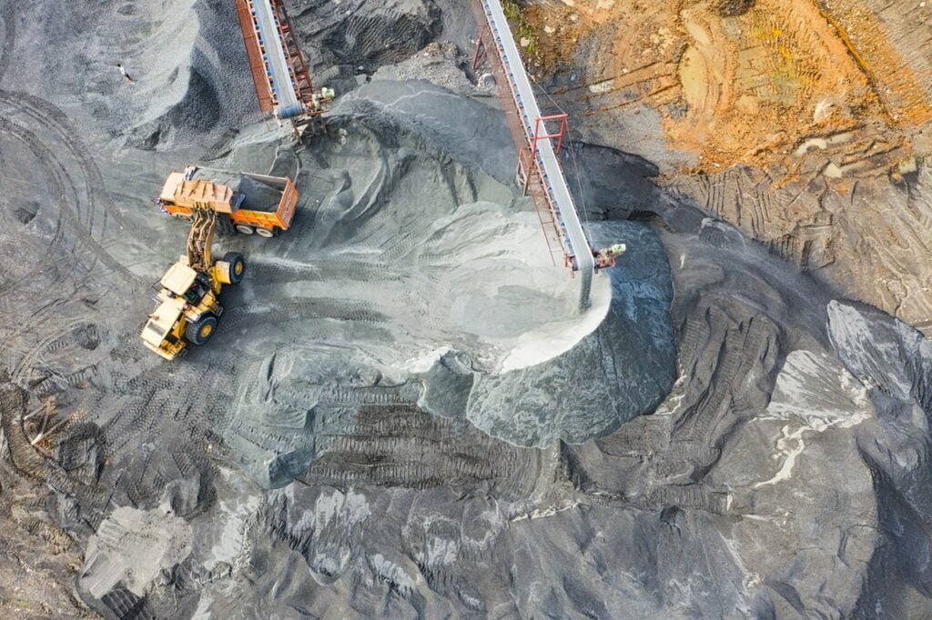
Mining
Oil and gas exploration
Differential Absorption LiDAR (DIAL) offers a new method of oil and gas exploration that is still in development. As well as being used to detect gases and particles, LiDAR mapping also provides an accurate 3D model of the terrain, minimising the project’s environmental impact.
Quarries and minerals
LiDAR also has uses in quarrying. It can be used to detect air pollutants, as well as surveying the surrounding land and gauge the project’s environmental effects. Using LiDAR, existing quarry sites can conduct fast surveys accurate to within a few centimetres.
Calculation of ore volumes
LiDAR can be used in mining to calculate ore volumes, penetrating the Earth’s surface to gather data on what lies beneath. Scanning of the areas is most commonly done with UAVs.
Robotic mining
Mine operators have long used LiDAR to assist with planning and slope stability assessment. But LiDAR has other uses in the mining industry: to determine what minerals lie beneath the surface of the earth, and in the analysis of mine structure to prevent them from collapsing.
Image recognition
Gesture recognition
Gesture recognition requires a fast response time. By measuring how far away an object is from the sensor, LiDAR can determine an object’s position in 3D space, measuring the distance a million times per second. This capability has automotive uses, for example, allowing the driver to use simple gestures to operate the vehicle’s infotainment system, as well as gaming uses. Facial recognition developer Digital Signal Corporation uses LiDAR to produce 3D facial scans at a distance, designed to improve security at airports.
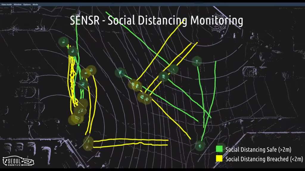
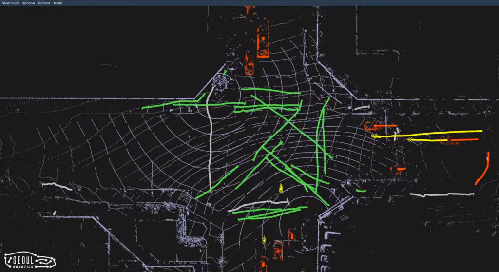
Motion analysis
The analysis of dynamic 3D scenarios with multiple moving pedestrians has received great interest in various application fields, such as intelligent surveillance, video communication and augmented reality. In one study, a rotating multi-beam LiDAR sensor was used in gait analysis and activity recognition. In another, it was used for the motion estimation of vehicles, providing a complete strategy for urban traffic analysis using airborne LiDAR. This capability has become especially powerful during the coronavirus pandemic where it has been used as a tool for monitoring social distancing.
Lip-reading
As LiDAR sensing becomes more advanced, we can use it for interpreting body language and face reading – including lip-reading. But it’s still in the early stages; lip reading is not just a set of skills, it is an art. Some sounds and words look very similar, relying very much on the lip reader’s background knowledge of the language.
Surveying
Virtual 3D designs
LiDAR scanning is an invaluable tool for accurately representing buildings and interiors in vivid detail. Thanks to its efficiency, speed and accuracy, it’s becoming widely used in architecture, construction and design. Architects and designers can use LiDAR technology to create virtual 3D representations of the projects they want to build.
Mapping and cartography
With its high resolution and accuracy, LiDAR can be used in the creation of maps. Its 3D capabilities make it particularly adept at mapping terrain models, such as mountain topography, as well as producing high-resolution contour maps.
Terrain modelling
With LiDAR technology you can take two types of elevation model: first return and ground. The first includes forest canopies and buildings (DSM), whereas the second contains only topography (DEM). As such, LiDAR can be used to create a detailed map of any given terrain, allowing scientists to study changes in slope and landform breaks.
Bathymetric mapping
Most of the initial uses of LiDAR were for measuring water depth. Depending upon the clarity of the water, bathymetric LiDAR can measure depths from 0.9m to 40m with a vertical accuracy of 15cm and horizontal accuracy of 2.5m. A green laser pulse is transmitted to the water surface where a portion of the energy is returned to the airborne optical receiver, while the remainder continues to the bottom and is subsequently reflected back to the receiver.
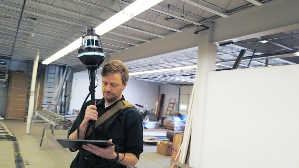
Terrestrial scanning
In terrestrial laser scanning applications, LiDAR is used to create a three-dimensional point cloud containing coordinate information from the entire details of an object. Hundreds of point clouds per square metre are produced from the scanned surface. These point clouds make it possible to produce accurate vector data for architecture and engineering projects.
Aerial scanning
Aerial LiDAR has many applications, from infrastructure and civil engineering surveys to agriculture, forestry, mining and quarrying. LIDAR systems used to be heavy and were previously only operated from manned planes or helicopters. However, manufacturers have now started developing compact, lightweight versions. UAV LiDAR has been one of the most eagerly anticipated technologies of the last 10 years, changing the way surveyors capture data and significantly reducing costs.
Ecological & land classification
ELC is the short form of ecological and land classification that provides physical and biological information about a given landscape to help with sustainable management. LiDAR technology is an ideal tool since it can map virtually any kind of physical environment, building the ultimate map and providing accurate data for civil engineering works.
Hydrographic survey
As sea levels rise and natural disasters become more extreme, there has been a renewed push to improve our understanding of the coastal zone. Bathymetric LiDAR is used to capture geospatial data of the coastline and shallow waters, facilitating the efficient creation of hydrographic data. These survey systems are typically aircraft-mounted to provide seamless coverage between land and sea.
River survey
Bathymetric LiDAR systems use a green wavelength to penetrate underwater. As such, they can measure aspects of river data such as depth, length and flow. This helps in understanding the nature of the river, as well as planning to avoid potential floods.
Urban planning and surveying
LiDAR data can be used to obtain digital models of the earth’s surface, which can be used in land use planning to create detailed city models. What’s more, these large area models can be generated at relatively high speed, compared to other techniques.
Architecture
Ground-based LiDAR is an ideal tool for designing and constructing new buildings, generating high-speed surveys that offer a precise digital map of the terrain and surrounding locality.
Building restoration
Additionally, with a ground-based LiDAR survey, it’s possible to capture the tiny details in building facades with great accuracy. This provides a valuable record of the present condition of the building. Sensors may also be used indoors to determine where things should go and act as proof of compliance with licensing regulations.
Structural deformations
LiDAR technology is used to collect information about structures and identify potential deformations. The pulses penetrate deep into structures to identify faults that would otherwise go unnoticed. The end product is a 3D parametric model of the deformed structure, which contractors can use to make corrections.
Sewer and manhole maintenance
Using LiDAR sensors mounted on robotic vehicles, we can take surveys of high-risk areas that would be dangerous territory for humans – inside sewer systems, for example – while also simultaneously measuring airborne pollutants.
Drainage analysis
LiDAR is used for drainage analysis in large scale developments. Underground drainage is often difficult to map out using other survey methods, whereas LiDAR pulses can penetrate both walls and surface to reveal the drainage structure underneath. LiDAR provides particularly valuable detail in areas of modified terrain, such as roads, offering particular benefits for road-building projects in flood-prone areas and areas with relatively flat terrain.
Viewshed analysis
A viewshed dictates surrounding areas as visible or non-visible from an observer’s POV. These analyses are a common function of GIS software. LiDAR technology can be used to create a DEM, from which one can conduct a viewshed analysis on any given piece of land to determine what will be visible from various different angles – helpful when planning new buildings or infrastructure.
Residential lighting
Light levels in our homes and workplaces can make a difference in the way we feel and even affect our health. LiDAR technology is used by residential lighting experts to redirect sunlight, ensuring that enough light reaches all houses within a given area.
Bridge inspection
Traditional methods of bridge inspection can be tricky and dangerous. Reliable inspection data is needed to make accurate performance predictions. LiDAR pulses can penetrate bridges to identify potential faults before, during and after construction. Due to its efficiency, LiDAR is now one of the cheapest and easiest ways to inspect bridges under development.
Airport infrastructure
LiDAR technology can be used to map out airport infrastructure and features like the runway, terminal building and hangar – pinpointing their exact location. This information is essential to airport security, preventing infiltration and accidents.
Tunnel surveying
Underground conditions are rarely suitable for conducting measurements – especially in areas that are not easily accessed by humans. This is where LiDAR comes in handy, allowing companies to take accurate and detailed measurements that can be used for analysis, assessment and modelling.
Edge detection
Using the spatial information contained within LiDAR data, we can detect and analyse objects and the edges of objects, such as bridges, buildings and roads. Road-edge detection, in particular, is an essential capability for autonomous vehicles. Similarly, edge detection may be used in bridge maintenance to identify a damaged beam or joint area, for example.
Transport
Transport planning
LiDAR’s high spatial resolution and mapping accuracy make it an ideal solution for the planning of transport and road networks. Airborne and ground-based LiDAR may be used in combination to capture data over large areas, as well as in fine detail.
Parking allocation
LiDAR technology can be used in autonomous vehicles to utilise and allocate parking spaces in a parking lot. In cases where parking spaces are limited and the vehicle needs to fit into a smaller parking space, a LiDAR sensor can guide the vehicle safely.
Traffic congestion
Traffic congestion, which causes environmental problems and accidents, is becoming increasingly acute. LiDAR sensors are used to monitor traffic congestion on roads and offer advice on alternative routes to be used. One of the goals of autonomous vehicles is reducing traffic congestion and pollution using these types of sensors.
Railway infrastructure
Laser scanning technology can be a game-changer when it comes to planning and executing transportation projects. Traditionally, railway track measurement was done by a regular survey system. Now LiDAR can perform the measurements in a fraction of the time: a fast, accurate and cost-effective solution to map complete railway networks.
Road design
It is, therefore, no surprise that LiDAR technology is commonly used in the designing of new urban and rural roadways. LiDAR data can be used to map out the exact road design, helping to create a stable road free of any design flaws and minimising the impact of new road construction and maintenance. This is particularly invaluable in high-risk areas with hilly, unstable terrain.
Other uses
Archaeology
LiDAR has proved invaluable to archaeologists – such as the mapping of ancient Pompeii by Kaarta – helping them to plan field campaigns and observe patterns not visible from the ground. DEMs can also reveal micro-topography hidden by trees and shrubs. LiDAR data is easily integrated with modern geographic information systems (GIS) for further analysis.
Military
The military uses 3D data capture for a number of applications. The detailed mapping of urban and non-urban terrain can greatly benefit military operations, both from the air and semi-autonomous vehicles. Among other things, it can be used for air defence, air traffic control, ground surveillance, navigation, search and rescue, fire control radars, and identification of moving targets.
Gaming
Using LiDAR, you can digitally recreate any physical object, rendering detailed, accurate models in very little time. In gaming, this opens a world of possibilities, allowing developers to recreate entire cities and locations almost identical to the real world.
Mobile network planning
One of the benefits of LiDAR is its ability to gather large amounts of high-resolution data in a short space of time. This makes it ideal for cellular network planning; determining the line of sight and viewshed for prospective cellular antenna – reducing costs in the process.
Mapping of wireless signal
LiDAR technology also has uses in wireless signal mapping, making it is easier to plan where each of the wireless transmitters will be positioned and to assess the strength and radius of the signal. LiDAR has been used in wireless communication system design, emerging as an alternative to the traditional method of digital orthophotography.
Medical applications
Cost-effective 3D LiDAR imaging is a real boon for healthcare. New imaging modalities are continually sought after – in fact, Navy researchers have applied LiDAR in combination with radar to identify tumours in the body.
Cancer image analysis
A hybrid LiDAR-radar system may be used for detecting the presence of objects, such as cancerous tumours, within tissues by detecting reflected signals from the tissue. This technique better discriminates scattered light associated with a cancerous mass from the diffuse scattered or backscattered light associated with healthy tissue.
Entertainment Industry
LiDAR has been used to record music videos without a camera, most notably for the song ‘House of Cards’ by Radiohead in 2007. More recently big hitters in the entertainment industry, namely Lucas Films and Industrial Light and Magic have realised that the level of accuracy that LiDAR provides enables them to control all of their visual effects at a far lower cost. LiDAR is changing the game in VFX and significantly scaling up the performance and accessibility of volumetric video and VR & AR productions.
Tourism and park management
LiDAR data is indispensable for tourism and park management; data analysis determines the best areas to use for various functions, such as where to build playgrounds, rides and footpaths.
Perceptual grouping
Perceptual organisation deals with grouping sensory inputs that originate from the same object. It offers a promising intermediate process toward object recognition and reconstruction from 3D surface points, which can be derived from LiDAR data. However, despite intensive research on 2D data, perceptual organisation of 3D entities is still in its infancy.
Laboratory testing
LiDAR is used in the laboratory testing of factors such as signal strength and fluid concentration. Being swift and precise, it offers an efficient way to measure test results.
Virtual tours
360° and virtual tours are becoming increasingly popular online. LiDAR pulses can be used to create virtual 3D and 2D representations of an area, which can be used to create virtual tours. Unlike other methods of survey, LiDAR generates a precise representation of an area. This is a particularly useful function for generating interest in tourist attractions.
Lost luggage
3D laser scanning technology could help to solve the airline industry’s lost luggage problem. Heathrow airport now has an autonomous dolly that moves bags from planes to luggage halls, providing a faster and more flexible loading process. If items are with an autonomous dolly, then everything can be accounted for more easily.
Nowadays, LIDAR is used in many different ways, transforming entire industries. And this is only the beginning. At Level Five Supplies, we work with LiDAR suppliers to deliver superior, affordable LiDAR sensors for your R&D projects.
Level Five Supplies has launched a range of specialist LiDAR training courses for 2022, designed to complement our other services and accelerate the tricky early stages of integration. Booking is open now.